Services
Mapspace
MAPSPACE is a powerful, user-friendly geospatial platform designed for professionals in urban planning, infrastructure development, and aerial project visualization. With MAPSPACE, you can view, explore, and plan your projects with ease! Get access to rich features such as access to 360-street-view, orthophotos, oblique images and point clouds for mapping and analysis - and much more!

MAPSPACE interactive map view
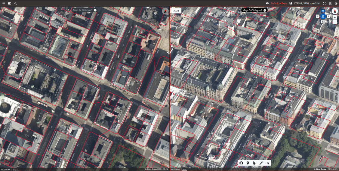
- MAPSPACE Map & Oblique Viewer allows users to search, navigate, combine, compare and extract information in several ways.
- The responsive design means you can display ortho and oblique in single or multi-view, load and view WMS/WMTS services and vector data as overlays.

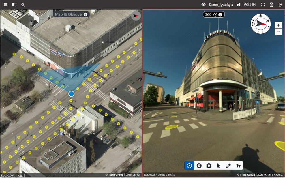
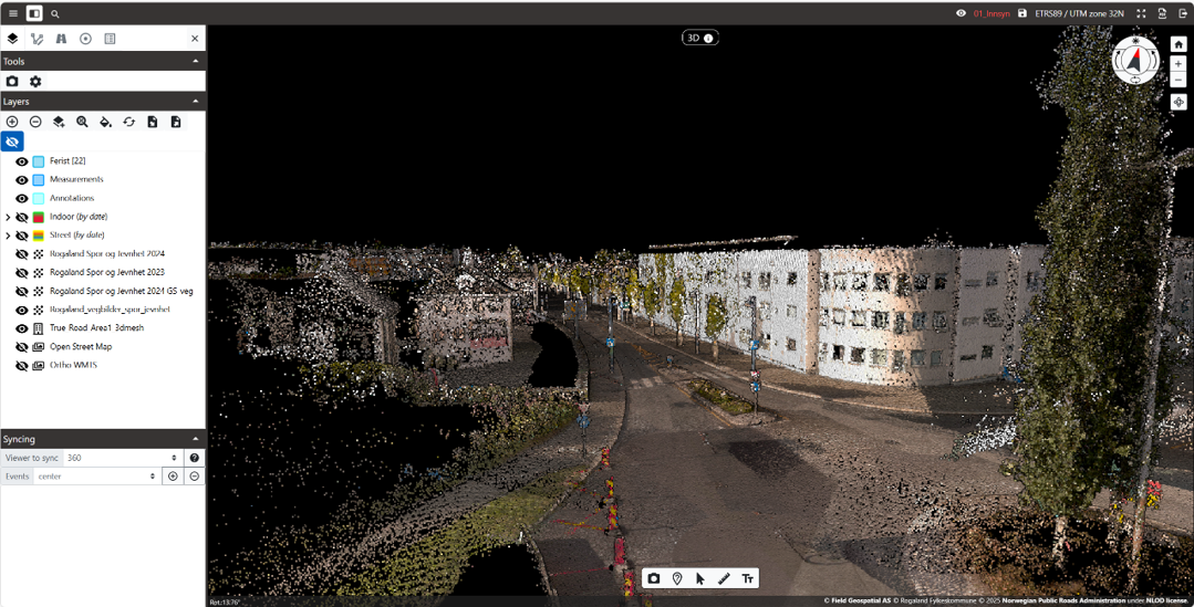
MAPSPACE 360 View
- MAPSPACE 360 View is a complete panorama viewer for images from a car, drone or classic terrestrial sensors.
- Display your 360 images synchronized with ortho/map, oblique imagery, and vector map data in multi-view, and load and view vector data as overlays.

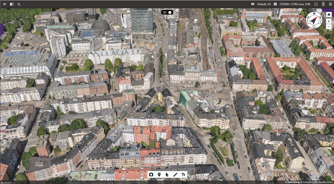
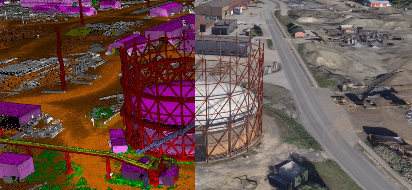
MAPSPACE 3D View
- Mapspace 3D View is a responsive 3D viewer for laser scanning (LiDAR) and 3D mesh models. It fast-streams LiDAR data, including laser classification features and RGB coloring.
- Explore your 3D data in single or synchronized multi-view with other data sources.
- Get insight into different locations with high-detailed 3D mesh models in urban and rural areas.

Cloud Storage
- Mapspace user has access to our cloud storage with their data, our simple productivity platform that keeps you in control, and protects your data.
- Download and share your data with userfriendly interface.
Integrations
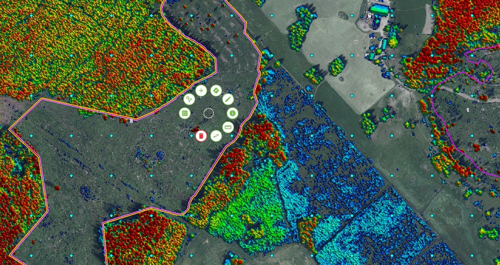
Mapspace offers complete integration of other services through WMS/WMTS. This service provides an internal WFS for hosting and viewing vector data and full support for displaying various analysis data — road surface condition and vegetation distance, for example — which is ideal for asset management. Mapspace also integrates into other web solutions using simple URL access or more sophisticated API connections.
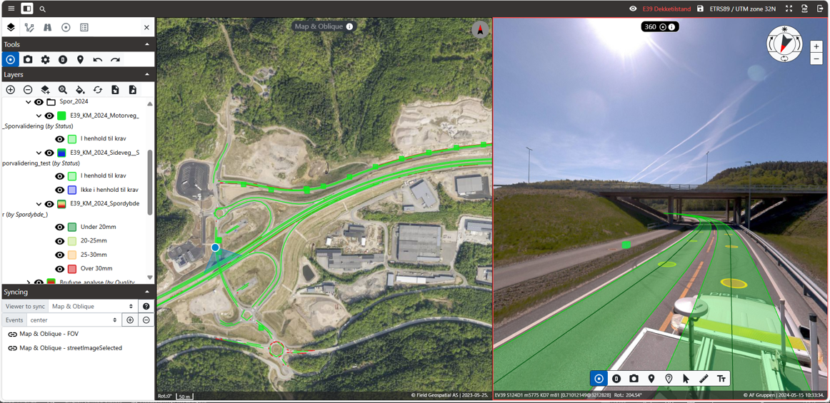
MAPSPACE Road Insight (Infrastructure analysis)
MAPSPACE 360-street-view
MAPSPACE - View with Vector and Raster Data
MAPSPACE 3D view
MAPSPACE Point Clouds
Get in touch
Norway
Dag Solberg
+47 971 73 336
dag.solberg@fieldgeo.no
Finland
Petteri Ryönänkoski
+ 358 400 928 739
petteri.ryonankoski@fieldgeo.fi
Sweden
Toni Selvli
Sales Manager
+46 706 777 649
toni.selvli@fieldgeo.se
Software
Field offers software products that bring value to customers and partners worldwide. Our cloud-based software products help our customers easily access and use their data. Our software products support external data sources like WMS/WMTS or local vector data to empower you accurately and provide valuable insights online. Explore more Field software and services below.

Geospatial solutions powered by software, sensors, and AI technologies
Join us and help capture and transform accurate geospatial data into valuable insights and digital twins.