Webinar: Mobile Mapping – efficient and precise mapping for infrastructure and construction

WEBINAR - TUESDAY 13TH MAY 2025
How do you map large and complex areas quickly, accurately - and without disrupting operations? What does artificial intelligence (AI) mean for the surveying industry and how do we utilize the technology in our services?
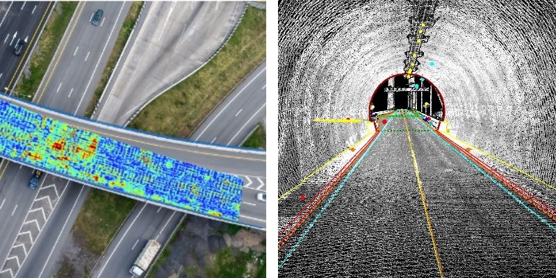
Join us for an inspiring webinar where our experts will give you insights into the latest trends in Mobile Mapping. We'll share experiences, show practical examples and demonstrate how we're combining ground-based and airborne technologies - with the support of AI - to deliver fast, reliable and precise solutions.
📅 Time: Tuesday 13 May 10:00-10:45
📍 Registration: Sing up for the event here
🎙️ Speakers: Ole Vanebo, Floris Jan Groesz and Dagfinn Solvik-Olsen
Note: This webinar will be held in Norwegian.

DETAILED AGENDA
- Welcome and introduction: Mobile Mapping tailored for different industries
- Mapping of industrial areas, transformer stations, pipe routes, roads, railways and facilities
- Efficient data collection - without stopping operations or production
- Supplemented with airborne LiDAR and photogrammetry
- Use of AI for faster processing, quality control and analysis
- From raw data to finished product - specific deliveries and examples
There will be Q&A via Chat.
Welcome to the event!
Insights
Related articles
From data to decisions: Explore how to use geographic data and visualization for smarter project planning
Field Strengthens Construction Innovation as HP’s First Certified SitePrint Provider in the Nordics
Mikko Salonen appointed new CEO of Field Geospatial
See all