
360 street view imagery
Professional 360° street-level imagery have become an essential tool for daily operations in municipalities and cities. With FieldROAD™, you gain access to a powerful, cloud-based 360 street view solution delivering ultra-high-resolution, geographically accurate insights captured along roads and rails.
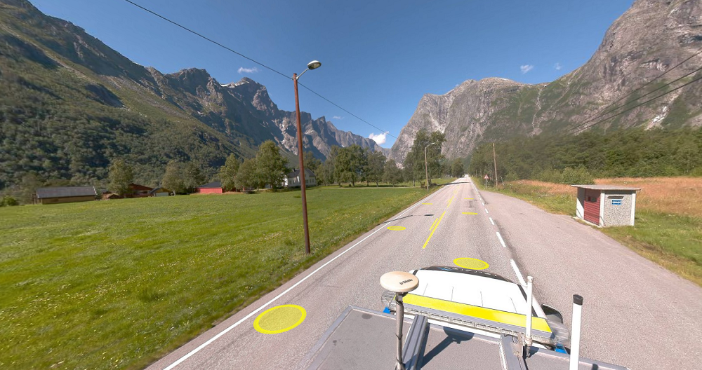
High-resolution, geospatially accurate street-level imagery for professional users.
FieldROAD™ is our premium 360° street view imagery product, designed for municipalities, infrastructure owners, and organizations that need reliable data for planning, documentation, and asset management.
FieldROAD™ delivers systematically collected street-level imagery with precise geographic positioning. The product is available through Mapspace, our cloud-based web portal where customers can access, analyze, and integrate their data — without any installation or local storage requirements.
The service provides:
- 360° panoramic street images
- HD image resolution
- Highly accurate image positioning (PPP/IMU/DMI)
- Measurement capabilities based on a laser-scanned surface model
Using advanced navigation systems, imagery is systematically captured to ensure consistent coverage and precise georeferencing. You always know where and when each image was taken.
![]()
Advanced measurements of street environments
The solution allows you to perform accurate measurements directly in the street images. Measurements are based on a surface model generated from laser scanning conducted simultaneously with image capture.
This allows you to:
- Measure distances and heights directly on screen
- Register objects in the street environment
- Collect infrastructure data efficiently
- Perform digital street inventory
All objects visible in the imagery can be recorded directly within the interface, making our solution a powerful tool for street-level data collection.
AI-Based Traffic Sign Recognition
We also offer AI-powered recognition and registration of traffic signs using FieldROAD™ imagery. This enables automated detection and documentation, saving time and increasing accuracy in road asset management workflows.
Seamless GIS Integration in Mapspace
To maximize value, FieldROAD™ can be integrated with your own geographic datasets inside Mapspace. By combining your GIS data with up-to-date 360° imagery, you gain a comprehensive operational overview that supports:
- Infrastructure planning
- Maintenance management
- Asset documentation
- Public space administration
Contact us if you have any questions or if you would like a demonstration of the solution.


Get in touch


Mobile Mapping & Geophysics
With laser scanners mounted on a car, we can acquire millions of points per second. This very detailed point cloud is used for creating 3D vector models and it is a basis for producing a TIN-model for advanced applications. At the same time with scanning, images and video can be captured. The images are 360-degree street view imagery that can be accessed and used in a separate web viewer, Mapspace. We can also collect information about road conditions and map utilities, groundwater and bedrock using ground penetrating radar. Explore our other Mobile Mapping & Geophysical Services below.


