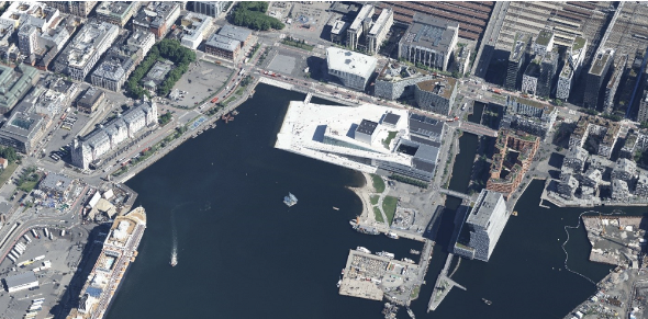
Services


Oblique imagery


Oblique imagery is aerial photography that is collected at an angle. Our customers use
oblique imagery for wide-ranging purposes including access to photorealistic 3D models
of cities, façade photos, terrain models based on image matching and detailed mapping
of infrastructure.

Oblique Imagery


Oblique imagery

Field is a leading supplier of oblique images. We capture oblique images from airplanes, drones and helicopters and use multiple custom oblique systems. 

One of our systems photographs image sets with five images simultaneously: one nadir image and four oblique images (forward, backward, right and left). The image sets are taken less than one second apart. Another system shoots with two oblique cameras (forward and backward) and one camera straight down while simultaneously performing laser scanning. This system is particularly suitable for detailed mapping and documentation of infrastructure such as railways.

Typical resolution or GSD (ground sampling distance) for the systems varies from less than 1 cm and up to about 15 cm, depending on the flight altitude. After collection, our team optimizes the images and performs digital post-processing where different lighting conditions and exposure settings are compensated for. This ensures that our images have good detail visibility and homogeneity in both light and shadow areas, and our customers receive a very high-quality product. Popular products include:

  • Photorealistic 3D city models
  • Detailed mapping of infrastructure such as railways
  • Visibility solutions
  • Façade images
  • Terrain models based on image matching

Our customers can access their data through our online cloud-based viewing solution, Mapspace, directly through a browser or integration using a rich programming interface (API).


Laser_scan_64x64

Aerial surveying

Field has a history of aerial surveying dating back to the 1950s. We offer high-quality sensor services that deliver accurate data for digital products and decision making. Our unique competency and our fleet of ultramodern aircraft and sensors can meet even the most challenging project requirements. We have our own line of unmanned aerial surveying systems and also partner with local service providers worldwide. Explore more Field Aerial Surveying services below.

Get in touch

Fredrik Hoff

International

Fredrik Hoff

VP, Airborne & Mapping

+47 995 96 282

Peter Mero

Finland

Peter Mero

Country Manager Finland

+358 40 4808010

Floris Groesz

International

Floris Jan Groesz

Business Manager, Remote Sensing and Analysis

+ 47 986 30 541

Charles de Jongh-1

International

Charles de Jongh

Business Development Manager, Airborne & Mapping

+47 465 77 931

Dag Solberg

Norway

Dag Solberg

Group Sales Director

+47 971 73 336

Toni Selvli

Sweden

Toni Selvli

Sales Manager, Airborne & Mapping

+46 706 777 649

Ulrika Jalkemyr

Sweden

Ulrika Jalkemyr

Business Manager, Airborne & Mapping

+46 702 553 554

Lasse Turunen

Finland

Lasse Turunen

Business Manager, Analytics & Software

+35 850 491 5180

Geospatial solutions powered by software, sensors, and AI technologies

Join us and help capture and transform accurate geospatial data into valuable insights and digital twins.