Services
Laser scanning is an effective method for documenting and digitizing a building, road, or terrain with high accuracy. We offer laser scanning from many different platforms and are experts in finding the right solution for our customers' needs, usually by combining different scanning methods.
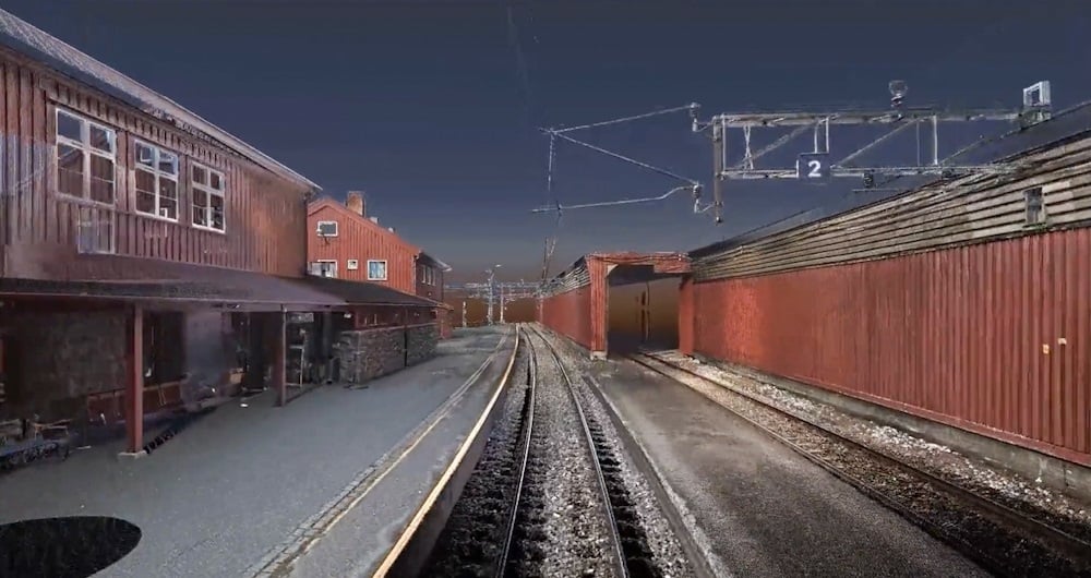
3D laser scanning is one of the most accurate scanning methods we use.
The laser scanner is static and moved manually from scan position to scan position, giving a very detailed point cloud with RGB colors and 360 panoramic images.
Point clouds with this accuracy and detailing are ideal for documenting an existing situation.
This method can be used in many different ways, including:

What is 3D scanning?
3D scanning uses various types of sensors to reliably measure and record objects in three-dimensional space. The resulting point cloud of data provides accurate point clouds of interior environments, buildings, or structures. This is useful in architecture, engineering, and other fields for accurate documentation and analysis of indoor environments.
What accuracy do you need?
The accuracy you order has a lot to do with the price. In general, the higher the accuracy you need, the more it costs. Consider what you will use the result for. And choose the accuracy according to your needs. We are happy to help you make the right choice!
Revit, ArchiCAD, and IFC models?
All three are BIM (Building Information Models). Which one do you need? Check who will be working with the model and what they prefer to work in. An architect will often prefer an ArchiCAD model. Others will prefer a Revit model. And some will only want a 2D drawing. Be sure before you order. You can save a lot of time and money here. We can also help you figure out what you need!
Do you offer Google Street View?
Are you tired of traveling to the project to take measurements and check things that were forgotten during the inspection? We can scan and create a Google Street View of your project so you can take measurements and even operate the building from your PC, mobile phone, or tablet.
What does LOD mean?
In 3D scanning, LOD refers to different levels of detail that can be selected based on the needs and purpose of the model. Lower LODs can be used to represent general shapes and contours, while higher LODs provide more detailed information, including smaller details and textures.
How does 3D scanning improve quality control?
A 3D scan is excellent for checking that what has actually been built is in accordance with the drawings. We use 3D scans and compare them with the BIM model. This allows us to see what is within tolerances and what is outside them.
3D laser scan model of rail network
Land surveying plays a critical role in the planning and execution phase for most infrastructure and construction projects worldwide. Land surveying ensures the accuracy between digital models and the physical world. The land surveying technique determines the accurate geographical three-dimensional position of points and the distances and angles between them. Our team has extensive experience delivering land surveying services for governments, businesses, and private individuals, predominantly throughout Norway but also in Sweden and Finland. Explore more Field Land Surveying services below.
Join us and help capture and transform accurate geospatial data into valuable insights and digital twins.